Thursday, November 13, 2014

The Climate of Moab, Utah

     Moab, Utah is classified as a high desert region, according to the Discover Moab website. Furthermore, its climate is considered a cold semi-arid steppe climate, as defined by the Weather Spark 
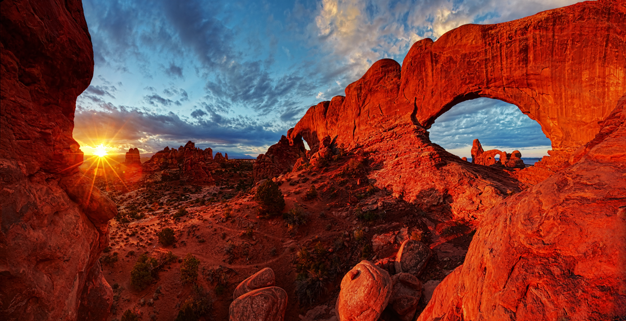
website. While spring and autumn are the peak seasons for Moab tourism due to its unique climate, the region maintains its beauty throughout the winter as well.

This photo highlights the autumn beauty of the formation
called Courthouse Wash, located in Arches National Park.
The spring and autumn seasons are prime times to visit Moab.
Photo courtesy of:Ron Niebrugge/WildNatureImages.com
and www.my-photo-blog.com
This diagram demonstrates the blanket-like quality of clouds
when trapping heat. Moab's lack of cloud coverage during
the summer and winter leads to clear sky radiation.
Photo courtesy of: http://climatekids.nasa.gov/review/
greenhouse-effect/cloud_greenhouse_effect-1.jpg
Moab’s elevation permits decreased cloud coverage during the summer and winter months. Clouds are in part responsible for absorbing insolation; thus, they act like a blanket in Earth’s atmosphere. Less cloud coverage means that less heat is being trapped by clouds. As a result, clear sky radiation occurs, as well as decreased night temperatures in the winter. 

     Another characteristic of Moab’s climate is its daily temperature differences. According to the Discover Moab site, the highest temperatures occur from 1p.m. to 4p.m. in the summer. However, noon is the typical time that maximum solar radiation occurs. This variability in diurnal temperatures occurs due to Earth’s nature of absorbing and reflecting radiation. This occurs over the course of several hours. 

     In addition to little cloud cover through the seasons and daily variations in its temperature, fast-approaching storms are characteristic to Moab’s climate. Forms of precipitation typical to the Moab region include rain that varies in intensity, light amounts of snow, and thunderstorms. During Moab’s warm season, which lasts from June through September, thunderstorms account for 62% of the precipitation, as seen in the below bar graph.

This bar graph shows precipitation values for
Moab's warm season. The prevalence
of thunderstorms in the region presents many
dangers to hikers and tourists alike.
Photo courtesy of: https://weatherspark.com/
averages/29941/Moab-Utah-United-States

Moisture and unstable air must be present to form thunderstorms. These storms mature through various stages and can cause intense rainfall, hail, lightning, and thunder. As a result, thunderstorms often present dangers to hikers in the Moab region.


     The climate of Moab is indubitably unique and causes weather that is “as varied as its landscape,” according to the Discover Moab website. 


References: 
"Earth's Atmosphere, Radiation Balance and 'Global Warming'" Lecture Notes
"Temperature of the Earth" Lecture Notes
"Weather" Lecture Notes
http://www.discovermoab.com/faq.htm
http://www.discovermoab.com/climate.htm
http://www.utah.com/nationalparks/arches/arches-winter.htm
Ron Niebrugge/WildNatureImages.com and www.my-photo-blog.com
http://climatekids.nasa.gov/review/greenhouse-effect/cloud_greenhouse_effect-1.jpg
https://weatherspark.com/averages/29941/Moab-Utah-United-States
Video courtesy of: www.youtube.com

Tuesday, October 14, 2014

Physical and Chemical Rock Decay around Moab, Utah

     The Moab region of eastern Utah offers prime landscapes where tourists can view abundant evidence of rock decay, whether physical or chemical. Such evidence contributes in part to the distinctive physical geography of Moab.

     Joints are fractures in rocks that allow for processes of weathering to occur. Joints are visible on numerous rock formations in and around Moab, including Arches National Park.
Numerous joints are visible on the left-hand 
side of this rock formation. This arch is located
in Hunters Canyon near Moab, Utah. (Photo by:
Katie Logar)

     Humans, for means of rock climbing in the region, utilize joints; however, the primary result of jointing is the promotion of weathering and later, erosion.

     Joints can form in two ways: either by contractional cooling/thermal expansion or by folding, faulting, or plate tectonics. In regards to sedimentary rock, which is abundant in Moab, joint contraction is a key process in creating features like arches and natural bridges.
Landscape Arch, located within Arches National Park, boasts
prime examples of jointing. Joints weaken the rock and allow
for weathering to break down the rock. (Photo courtesy of: 
http://upload.wikimedia.org/wikipedia/commons/c/c9/
Landscape_Arch_in_Arches_National_Park.jpg)


     While joints pave the way for future weathering and erosion, other physical decay process take their toll on the desert landscape. One such process is salt decay, which can cause cavernous decay. Alveoli and tafoni are forms that evidence cavernous decay. Both are examples of vertical weathering characterized by holes found in rock surfaces. Alveoli are small, relative to the size of one’s finger, while tafoni are larger—roughly the size of one’s fist. Both forms are visible in the Moab region, due to its desert-like climate.
This sizable cave located near Corona Arch houses examples
of tafoni and alveoli. These holes in the surface of the rock
are caused by cavernous decay. (Photo by: Jessica Logar)


     While salt decay creates unique landforms, wind does not. Simple physical and chemical decay processes shape unique formations, like many of the arches located in Moab. This is evidenced by their rough—not smooth—surfaces.
This diagram demonstrates the process of arch formation by
physical and chemical decay processes--not by wind formation.
Wind lacks the power to shape such formations over time. 
(Photo courtesy of: http://thelifeofyourtime.files.wordpress
.com/2012/04/archformation.jpg)


     In addition to physical decay, chemical decay also occurs in the Moab region. One product of rock decay is the formation of new crystals, which leads to the creation of rock varnish. This provides a backdrop for ancient rock art, which is abundant near Moab.
Rock varnish on a panel near Moab provides a dark backdrop
for petroglyphs. Similar Indian rock art panels can be found
 elsewhere in the region. (Photo courtesy of: http://www.real
-dream-catchers.com/images/KokoHunt.jpg)

     Tourists can observe evidence of physical and chemical rock decay around Moab, Utah.


References:
"Decay of Earth's Rocks (weathering): the Key to our Beautiful Earth" Lecture Notes
http://upload.wikimedia.org/wikipedia/commons/c/c9/Landscape_Arch_in_Arches_National_Park.jpg 
http://thelifeofyourtime.files.wordpress.com/2012/04/archformation.jpg
http://www.real-dream-catchers.com/images/KokoHunt.jpg
http://www.discovermoab.com/rockart.htm


Monday, September 15, 2014

Basic Rock Types Around Moab, Utah

     The Moab region of eastern Utah contains access to numerous state and national parks, each of which boasts its own beautifully unique rock formations. Two specific areas around the city of Moab contain gorgeous examples of two of the three basic rock types: sedimentary and igneous rock. These areas include Arches National Park and The La Sal Mountain Range.

This photo features a handful of the 2,000 arches located within Arches National Park. The park contains numerous other geological formations in addition to its beautiful arches. 
(Photo courtesy of: Jim Karczewski - National Park Service (http://blog.usa.gov/post/20179890214/from-americas-great-outdoors-arches-national))

Taken from within Arches National Park, this photo reveals the not-so-distant La Sal Mountain Range. This range contains examples of igneous rocks.
(Photo by: Jessica Logar)


     According to the Discover Moab website, Arches National Park contains "the world's largest concentration of natural sandstone arches." Sandstone, as we have learned, is a typical clastic sedimentary rock. Sedimentary rocks are those that are formed when sediment accumulates in layers, called strata. The term "clastic" refers to a classification category of sediment that is comprised of fragmented pieces of pre-existing minerals or rocks. The type of sediment that makes up sandstone is none other than, yes, sand! The size of the clast that makes up sandstone ranges anywhere from 1/16 mm to 2 mm. 


This diagram helps to visualize the processes that must occur in order for sedimentary rock to be formed. From this, we can understand how sand was pressured and cemented in order to form the red sandstone rock arches within Arches National Park.
(Photo courtesy of: http://image.slidesharecdn.com/5-2sedimentaryrocks-130115232148-phpapp01/95/52-sedimentary-rocks-1-638.jpg?cb=1358314228)  
     Arches aren't the only sandstone formations to be featured within the park. Sandstone fins can also be found here. Regardless of the shape of the formation, both are comprised of sedimentary rock.
This photo features massive sandstone fins, located in Arches National Park. These fins, like the sandstone arches found in the park, are formed through the same processes.
(Photo courtesy of: http://www.discovermoab.com/images/arches/a03.jpg)


     The La Sal Mountain Range, located southeast of Moab, is partly comprised of another one of the three basic rock types: igneous rock, This relatively small range of mountains contains some sedimentary rock as well. In its formation process, molten rock repeatedly attempted to swell upwards until a dense layer of sedimentary rock blocked its path from erupting as a volcano. Since the magma was never able to explode onto the surface, it eventually cooled down during the solidification process. Later during the Ice Age, glaciers wore away at the peaks of the mountain range, revealing the igneous core. These types of rocks are formed due to the cooling and crystallization of molten rock. 

The La Sal Mountains are featured in the background of this photo. Igneous rocks played a key role in their formation and can even be found at the peaks of the range.
(Photo courtesy of: https://c1.staticflickr.com/5/4090/5005922833_81766ec4d1_z.jpg)

     Sources: 


Sunday, August 31, 2014

Introduction

     Hi! My name is Katie Logar and I am currently a freshman at CU Denver. I am an undeclared business major and while I'm not majoring in Geography, the subject has always fascinated me.
     For this blog, I have chosen to spotlight the beautiful physical geography of Moab, Utah and the surrounding areas.
This photo of Corona Arch (located just outside of Arches National Park) was taken just after sunrise in the spring of 2014 by my sister, Jessica Logar, when my family vacationed to the area.

     I fell in love with the unique landscape of the Moab area when my family and I started to take vacations there about 5 years ago. I'm constantly in awe of God's magnificent creations located there and I am very excited to learn more than I currently know about these land formations which never cease to amaze me. I am most fascinated by the spectacular red rock arch formations which have indubitably made the region famous. These arch formations are certainly not all that Moab has to offer, though. Throughout the course of this blog, I will showcase the best of Moab.
     It is my hope that the research I do for this blog will allow for a better-educated trip when my family and I return to Moab later this year.